


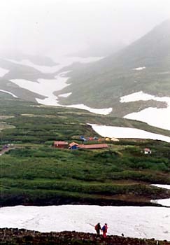


Asahikawa is centrally located and has some Ainu settlements nearby, so it's worth a visit in its own right. There’s also a bikepath (which goes west and not east, unfortunately). But the main reason people come to Asahikawa is because of its proximity to some of Hokkaido's most spectacular mountain scenery. A short distance east of the city is Sounkyo, the central mountain community in the Daisetsuzan Mountains. The town itself is not large and it's a bit of a tourist town... and it's on the main road, so it's not really a "mountain" area. But it affords unparalleled access to peaks that would normally take much more time and effort to get to - as a youth hostel manager once pointed out, in very few if any other places in Japan can you take a cable car all the way up to above 2000 meters elevation - as you see here, in this photo taken in mid-August...
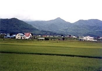
Due to weather and time considerations, I decided to skip the next portion of the route (Sapporo to Asahikawa) which leads straight from one large city to another. The traffic jam I saw from the train window was ample evidence of the wisdom of that choice. There was some nice scenery, though, so if you're traveling at a less crowded time of the year you should consider doing the route in full (there are alternate roads beside the main route which should make it a bit more pleasant). After all - what's another 140-odd kilometers?