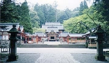


On this particular trip, though, I made the fatal error of reserving a room at the youth hostel in nearby Kirishima, the site of one of Japan's major shrines. They look close distance-wise, but the map doesn't go out of its way to point out the big difference in elevation. After I had descended around 500 meters (in height, not distance), I realized that I wasn't going to puff back up to Ebino early the next morning as originally planned. Hence I repeat my advice to spend the night at Ebino, and see Kirishima the next day as a break from the leisurely descent.
Ebino Kogen also provided the "nature shot" of the trip... though in some ways the "long shot" of the deer against the unusual trees and hillside was an even better photo. Deer and many other animals run wild on the plateau.