MAPhttp://www.kancycling.com/KANcycling/Map.htmlhttp://www.kancycling.com/KANcycling/Map.htmlshapeimage_8_link_0

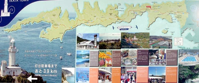
Here is a nice billboard with a map of the peninsula, showing its lightning-bolt configuration (though it’s been quite compressed, as you can see from a comparison with the map on the Route page). The red marker indicates the current location; it’s 39 km from there to the lighthouse at the tip of the peninsula.

Alternatives../Hokkaido_Okhotsk/Hokkaido_Okhotsk_Alternatives.html../Hokkaido_Okhotsk/Hokkaido_Okhotsk_Alternatives.htmlshapeimage_13_link_0
Story & PhotosSadamisaki_Story_%26_Photos.htmlSadamisaki_Story_%26_Photos.htmlshapeimage_14_link_0
Nuts & BoltsSadamisaki_Nuts_%26_Bolts.htmlSadamisaki_Nuts_%26_Bolts.htmlshapeimage_15_link_0
AlternativesSadamisaki_Alternatives.htmlSadamisaki_Alternatives.htmlshapeimage_16_link_0
RouteSadamisaki_Route.htmlSadamisaki_Route.htmlshapeimage_17_link_0
SADAMISAKISadamisaki.htmlSadamisaki.htmlshapeimage_18_link_0

And here is a better view of the actual road, showing one of the rather nice bridges along the way.