


Here's the aforementioned bikepath sign. The arrow points to Nara Koen (the famous Nara deer park) and gives the official name of the bikepath: the Nara-Nishinokyo-Ikaruga Bikepath. Nara is self-explanatory; "Nishinokyo" literally means "Western Capital" or the western part of Nara, the ancient capital prior to Kyoto; "Ikaruga" is the part of Nara Prefecture where Horyuji temple is located.
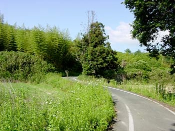
As soon as you turn onto this bikepath, you're in another world, and the cars are a thing of the past. This section of the bikepath only goes for a few kilometers, but it's the perfect way to travel the final distance to Nara.