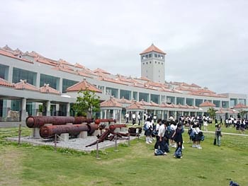


Once around the southeastern tip, the road turns into one with pleasing ups and downs... as opposed to the challenging ones on the northeastern coast of the island. Coming up: the main war-related sites.
This is Mabuni-no-oka, the place where the horrendous fighting on Okinawa finally ended. You can spend the entire day here exporing all of the war-related sites; not far away is the cliff where 35,000 people died in a last-ditch defense or jumped to their deaths below. Much nearer to Naha is the ex-Imperial Navy HQ (just south of the city) where you can tour the honeycombed caves from which the Japanese troops operated. And another cave further inland, Gyokusen-do, is the second-largest stalactite cave in Japan with almost 1 km open to the public.