


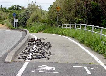


The bikepath curves gradually up and over the point. It's apparently so sparsely transited that local residents have no problem spreading their wakame seaweed right on the asphalt to dry. This is actually a common sight in rural Japan; friends tell me it's also common in other places like South America.
This view from a place near the top of the point proves that a "gradual" climb does not preclude achieving considerable elevation. You're looking in the direction of Ise, but heat haze and some clouds made it impossible to see the other shore clearly.